Route Description
In the Wind River High Route Guide there are turn-by-turn directions, both in narrative form and in annotations on the maps. The route description below is an overview.
The heart of the Wind River Range High Route lies between the range’s southernmost and northernmost named 13,000-foot summits, Wind River Peak and Downs Mountain. For an end-to-end thru-hike, the most obvious trailheads are on the range’s east side: Bruce Bridge, 15 miles west of Lander, and Trail Lakes, 10 miles west of Dubois.
There is west-side access, too — via Big Sandy and Green Lakes — but they involve a longer shuttle; the route in the south is less clean, too. For thru-hikers on the Continental Divide Trail, there are several options to link with the route from the south and north.
From Bruce Bridge, climb out from Wyoming’s high grasslands and sage, into the lodgepole forests typical of mid-elevations in the Rockies. The 15-mile hike to the base of Wind River Peak is an opportunity to acclimatize and work out the kinks before it gets real.

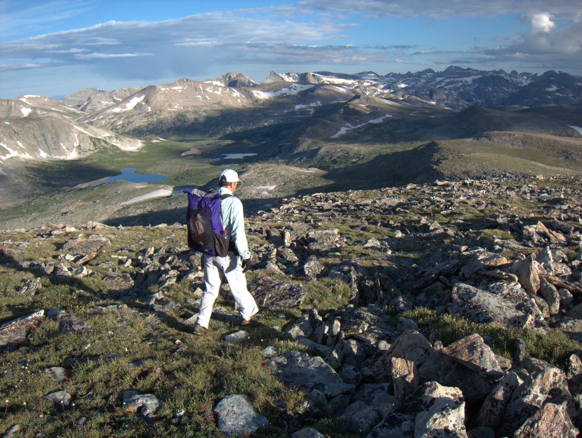
Looking north from Wind River Peak, the southernmost 13,000-foot mountain in the range. On a clear day, the range’s northern peaks are visible.
After summiting Wind River Peak, which thanks to its prominence provides a view of the range’s northern peaks, descend the steep and loose West Gully to Black Joe Lake. From the outlet, follow trails into the world-famous Cirque of Towers, and exit off-trail via New York Pass or the easier and less direct Texas Pass.

To skirt a corniced snowfield on the south side of New York Pass, Peter Bakwin follows a wide ledge system just below massive granite cliffs.
The next three pass-and-valley pairs follow the same fault line: the upper East Fork and Raid Peak Pass, Bonneville Basin and Sentry Peak Pass, and the upper Middle Fork and Photo Pass.

From Sentry Peak Pass, the next obvious high point is Photo Pass, 4.5 miles across the upper Middle Fork valley. In the event of bad weather, there is a low-elevation bypass via Halls Lake.
At Photo Pass, enter the Wind River Indian Reservation, for which a permit should be obtained. Descend to 10,100 feet in the South Fork of Bull Lake Creek before climbing again to the Continental Divide and returning to public land.
Walking north atop the Continental Divide north of Europe Peak
Follow the Divide for a few miles, including over Europe Peak, before taking a 330-degree bearing to Golden Lakes, over Douglas Peak Pass, through the barren Alpine Lakes basin, and over Alpine Lakes Pass. Indeed, it’s easier said than done.

From Lake 10787, Douglas Peak Pass looks very intimidating: steep and loose. Looks are deceiving: there is a slick route along the east wall that is steady and mostly stable. My effort was complicated by lingering hail from intense thunderstorms the night prior.
In the North Fork of Bull Lake Creek, find Sound of Music-worthy scenery: soaring peaks, large glaciers, lush alpine tundra, and milky gem-colored rivers. The climb out over Blaurock Pass is stout: in 1.2 miles it rockets 2,000 vertical feet up, to 12,750 feet. Sadly, all of that elevation is lost on the descent to the Dinwoody Glacier.
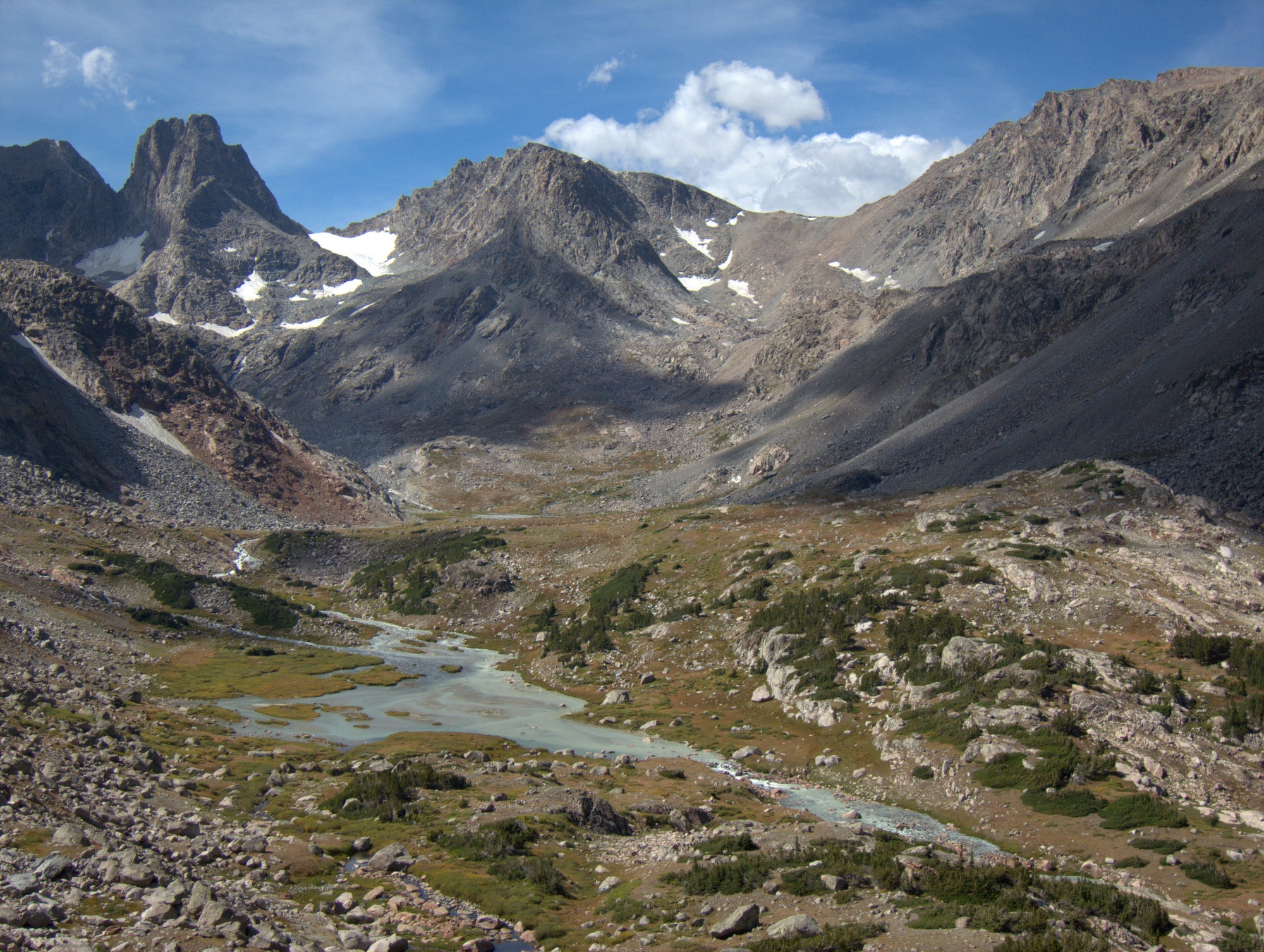
Overlooking the Middle Fork of Bull Lake Creek, one of the prettiest views on the Wind River High Route. My next objective is in view: Blaurock Pass, the low spot on the ridge with the clouds above it. It’s a 2,000-foot off-trail climb, mostly on scree and talus.
Here, start the most rugged and most committing section of the entire route. Alternatively, if it’s not meant to be, exit 20 miles to Trail Lakes via Glacier Trail.

The not-too-terrible exit from Dinwoody Creek via Glacier Trail. Gannett Peak, Wyoming’s high point, looms large.
From West Sentinel Pass, shoot across the Gannett Glacier to the saddle east of Flagstone Peak. Gain the Continental Divide and loosely follow it for eight miles, to Downs Mountain, dropping below 12,000 feet just once. Traverse Goat Flat to Glacier Trail and the northern terminus of the Wind River High Route at Trail Lakes. If weather is approaching, drop off Goat Flat and exit via East Torrey Creek, instead.

Bear Basin in upper Clear Creek, as seen from the Continental Divide. Other “high route” proposals can be found four-thousand feet below in the upper Green River valley.
I was with a small group of women who hiked/backpacked in the Wind River Range in the summer of 1980 or 1981. Our goal was the get as close as we could to Gannett Peak, but one of our colleagues had a very difficult time with the hike and elevation. I would love to find a good hiking map from that time.
Thank you,
Leslie Latimer Sapadin
I recommend Caltopo for digital maps of the Winds, and for exporting field-friendly maps. For one overview map of the range, use the Beartooth Press map.
Does the guide available for purchase include a route back to the CDT? I’m thinking of attempting this route as part of a thru hike and looking at Caltopo, it looks like breaking off from your route at Downs Mtn and heading west to meet the CDT north of the Green River Lakes TH would go. Would love to get some more detailed info on that if it were part of your guide.
Thanks!
Yes, it includes maps for linking the CDT with the Primary Route in both the north and south.
In the north, you depart the route atop Downs, and head northwest into the Roaring Fork. Rejoin the CDT just after it crosses the creek.
In the south, you depart the route atop Wind River Peak, and go south to Coon Lake, where you can drop off the ridge west to rejoin the CDT next to Little Sandy Creek.
Great, thank you!
Hiked a modified south-bound version of your route years ago with my dad and brother; planning to return solo this year, curious if there’s a reason you favor north-bound vs south-bound? Thanks!
The north is more difficult and at higher elevations, so going northbound gives you a chance to get your legs before you’re in it. But one good reason to go south: If you have a forecast showing better weather at the start than at the finish.