Are you ready for the High Route?
Is the Wind River High Route right for you? Without more personal context, I can’t say. But I can provide information about the route that will help you make your own decision.
A WRHR thru-hike is extremely demanding from start to finish, and a section-hike will similarly be so for at least some portions. Here is what it takes:
1. Physical fitness
Here are some simple facts about the High Route:
- It averages 620 vertical feet of change (up and/or down) per mile, compared to 420 ft/mi for the Appalachian Trail, 375 for the John Muir Trail, 310 for the Pacific Crest Trail, and 300 for the Continental Divide Trail.
- It typically hovers between 10,000 and 12,000 feet above sea level, where there is 65-70 percent as much oxygen as there is at sea level.
- Two-thirds of its distance (65 out of 97 miles) is off-trail, which ranges from joyous cruising through alpine tundra or sub-alpine to slow scrambling on granite slabs or refrigerator-sized talus.
- Starting food weights will be considerable because resupply points are inconveniently off-route. Unless you hire a pack outfitter to drop off food en route, expect to carry all your food from start to finish.
In short, the High Route is a very physically ambitious route. Expect to get worked, especially if you are under-trained.

Buzz Burrell descending the West Gully on Wind River Peak, which is perhaps the nastiest section of the route: it’s steep, loose, and long. While a bit of an anomaly, significant travel over talus, slabs, and snow is a guarantee on the High Route.
2. Backcountry skills
Regardless of the time of year, the High Route demands excellent navigation skills. Know how to read a map, operate a compass, dead-reckon and predict pace, use a GPS smartphone app, and — most importantly — identify the path of least resistance between two points. If you have limited navigation experience, you should expect to cover even fewer miles per day, and you may consider partnering with someone else to improve navigation accuracy.
Snow and/or glacial ice covers some sections of the route year-round, and snow coverage will be extensive early in the season (June and July). Ideally, you are already comfortable traveling on it; if not, be ready to learn. Glacier travel skills are not required — there is minimal crevasse danger, and the entire route can be done in running shoes and without a rope. Micro crampons are recommended for all seasons, for crusty morning snow and/or exposed glacial ice; an ice axe may be warranted for early-season.
Other essential skills include river fording, and the management of mosquitoes and sun exposure.

The Gannett Glacier, looking south towards West Sentinel Pass. In late-August after a dry winter, the glacier was almost entirely snow free. There were no crevasses through this section, and no crampons were necessary because the ice was covered in gravel and sand.
3. Emotional maturity
The idea of wilderness is very appealing, but being in wilderness can in fact be stressful, if not scary. The considerable distances from safety, the overwhelming sense of solitude, and the discernible presence of environmental risks lead to a very strong realization of self-dependence. Some backpackers become addicted to it, while others return to more blissful endeavors.
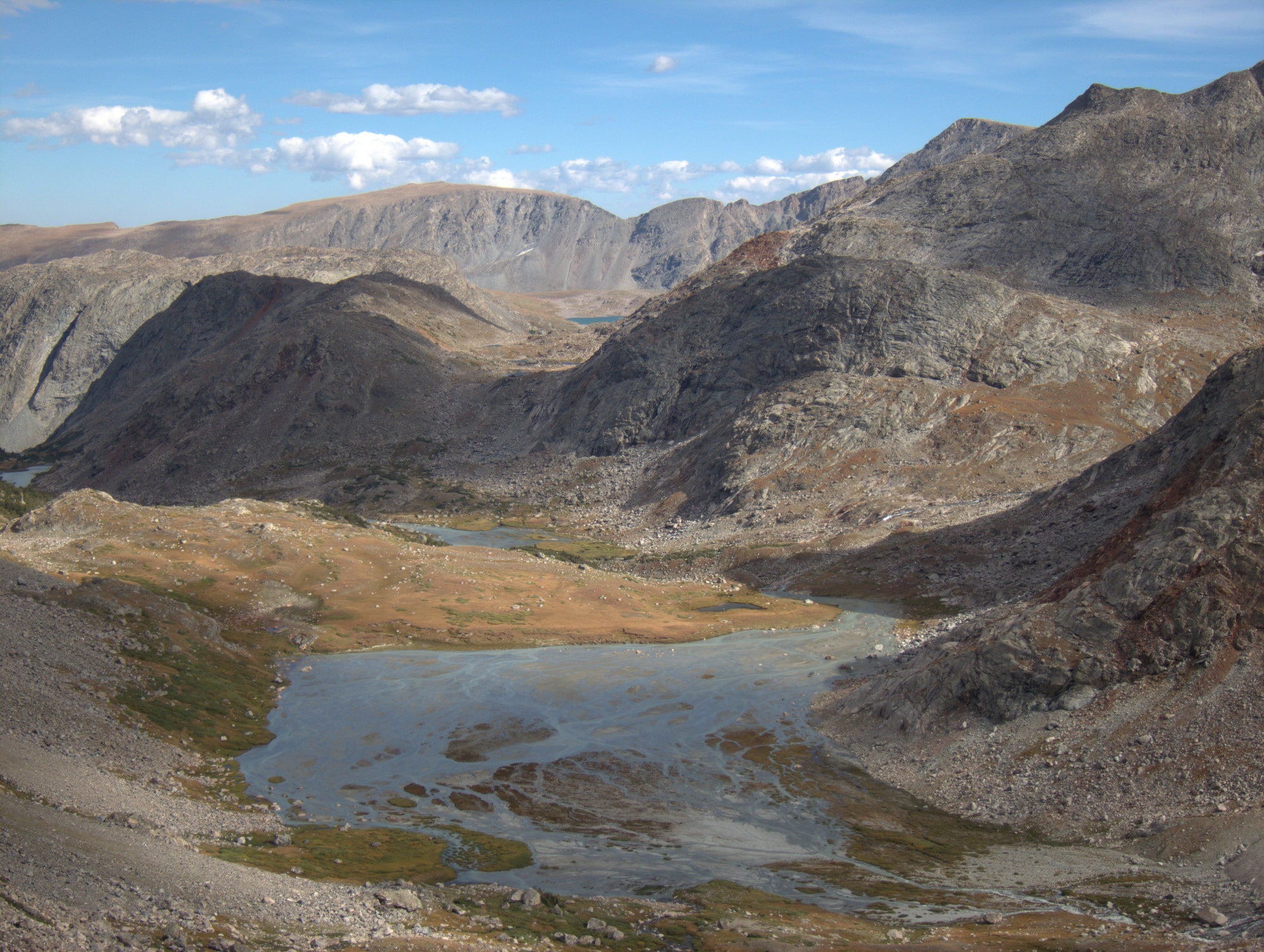
The upper headwaters of the North Fork of Bull Lake Creek, a rarely visited part of the Winds
Hello –
I am planning on doing the WRHR (a version) this summer (4 week weather window last 2 weeks or August/first 2 of September).
I was wondering if you know of any navigation courses, either online or on Jackson WY area.
I do multiple, multi days trips each summer, but always use my GPS on phone. The WRHR will be a big step up in length & duration and I want to get comfortable using a compass.
Any suggestions would be great
Mike
You may be able to find an orienting club in your community. That would help you learn how to orienteer in that environment, and then you could apply those same principals to the Winds.
Depending on where you live, I could potentially connect you with one of our guides, too. They could do a nav-heavy day course.
Colorado Mountain Club (CMC) is good about teaching map & compass skills.