Section Hikes

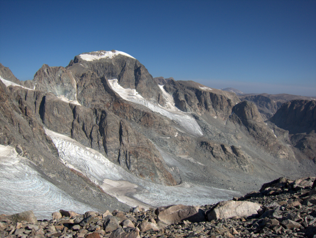
A view of Wyoming’s high point, Gannett Peak (elev 13,809′), from Bonney Pass, which the topographic and probably emotional high point for two section-hikes.
The Wind River High Route is best done as an end-to-end thru-hike. But a better option for many backpackers will be one of the eight recommended Section Hikes. The Wind River High Route Guide includes dedicated maps, datasheets, and route descriptions for all eight. These itineraries have several advantages:
1. Shorter trip duration
Few can dedicate 7-10 days to the Primary Route, or longer once travel time is considered — or want to. Because the Section Hikes are shorter and have more on-trail miles, they can be completed in less time, more like 3-7 days not including travel.
2. More balanced
The Primary Route is intense: it has extensive off-trail travel and endless vertical change. The Section Hikes are more moderate, and therefore more appropriate for those with less fitness, less experience off-trail and with high routes, and/or a preference for Type 1 Fun (“fun to do, fun to talk about later”) over Type 2 Fun (“not fun to do, fun to talk about later”).
3. More flexible
Each Section Hike has potential shortcuts and extensions, in the event that your original itinerary proves too long or too short. There are also multiple peak-bagging options to soak up extra time. For this reason, Section Hikes are an excellent introduction to the high route experience, before you have developed an understanding for your abilities.
4. Loops
All Section Hikes start and finish at the same trailhead, eliminating the need for an unreliable hitchhike, or an expensive and time-consuming shuttle. Look at it this way: by section-hiking, you just added nearly an entire day of backpacking to your vacation.
Hi, is there a map overview of these loop hikes I can view just to get a general idea of the route? Thank you!
There is a GPX file included in the guide that has sufficient points to visualize the section hikes.