Featured

Footwear is consistently the most discussed topic among the clients on our guided trips in southern Utah during the planning phases. It comes up in our online discussion board, during gear list reviews, and on our virtual group calls. Why? I think it’s due to: This post should be helpful for any reader who is…

For about twenty years and almost exclusively I have used Aquamira ($15) to purify backcountry water sources. And it’s been the only purification method used by the guided trip program that I started in 2011 and that has over 1,000 alumni. Last month two of these alumni emailed me separately, asking for a written explanation…

As atmospheric rivers crashed into the High Sierra during the 2022-23 winter, I had two primary reactions. I was: In 2023 backpacking trips in the High Sierra will be more difficult and risky than identical itineraries in past seasons. However, it’s possible to accurately predict, entirely avoid, and/or safely manage the challenges. Personally, I think…

During a flight tour in April, the National Park Service discovered that a critical bridge over the South Fork of the San Joaquin had been damaged. For photos, refer to the PCTA website. This bridge is in the northwestern corner of Sequoia-Kings Canyon National Park, just south of the boundary with Sierra National Forest, and…
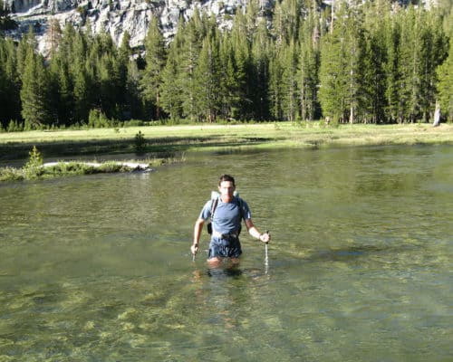
Update (May 18, 2023): Refer to this post for detouring around the damaged bridge over the South Fork of the San Joaquin. Update (May 22, 2023): More bridges are down. Plan accordingly. Every spring, creeks in the High Sierra rage with snowmelt. For one to two months, they are a grave danger, especially after snowy…

Last year the National Center for Environmental Information (NCEI) updated its website and launched two new tools for researching historical temperature and precipitation data. The good news is that the website is now more user-friendly; the bad news is that my older tutorial, posted in March 2021, is obsolete, so it’s time for a new…

Let me sound old for a minute. When planning the Sea-to-Sea Route in early-2004, I relied on USGS 30- x 60-minute paper maps at 1:100,000 scale to plot, measure, and follow a 700-mile route across North Dakota and Montana to link the North Country and Continental Divide Trails. Two years later, when planning the Great…

When I began backpacking nearly twenty years ago, I used toilet paper exclusively for cleaning my butt after pooping, just like I did at home. I’ve pooped outside thousands of times since then, and now prefer to do the exact opposite: I use no toilet paper at all. Instead, I rely on natural materials, a…

In a recent post on my favorite resources for researching the conditions that I will likely encounter on a backpacking trip, I plugged the Environmental Centers for Environmental Information, which tracks temperature and precipitation data for thousands of locations throughout the United States. It’s an extremely helpful website, but it can be difficult to navigate…

Nineteen years ago at the start of my first real backpacking trip — an over-my-head thru-hike of the Appalachian Trail — I was simultaneously over-, under-, and mis-prepared, and had justified many decisions on the basis of what if and just in case. For example, I had three methods of purifying water but only “water-resistant”…