Kings Canyon High Basin Route

Charlotte Lake Kelby, The Brawn, and I started our KCHBR thru-hike loop at Onion Valley TH and walked to Charlotte Lake from Kearsarge Pass. Kelby planned to hike with us to “PR-51” at LeConte Ranger Station and we would all hike over Bishop Pass together. Kelby would leave in his rental car to catch a…

Cautionary Advice Boy did we read Skurka’s cautionary advice at a sensitive time. We were in the middle of rationing our way to running out of food, an impassable cornice had blocked King Col, we had a physically challenging time descending Should-Go Canyon…and had high anxiety not knowing if it would even go near the…

We skipped Ionian Basin due to Skurka’s cautionary advice. Our less-than-perfect encounters with King Col, Should-Go Canyon, Woods Creek, Dumbbell Pass, and Amphitheater Pass were still fresh in our minds. Connecting our steps via the Middle Fork Trail still gave us that special brand of satisfaction that a thru-hike brings. We also got to see…

Simpson Meadow Trail I ate a nice big breakfast. Our food bags were full again, so I was back to my normal, stick-to-the-ribs pot full of energy. By the time we got to the “small trailside campsite at Horseshoe Creek” (which I thought was kinda big), I was feeling sick to my stomach. The problem…
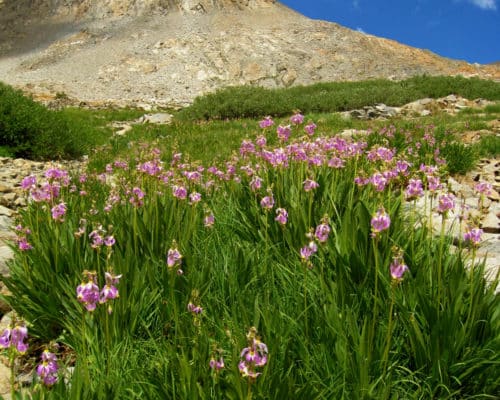
Where We Camped, Approximate Daily Mileage 2016 1. Tarn below Mt Silliman. 5m 2. Lonely Lake. 12.5m 3. Just shy of Colby Lake, just past “PR-15”. 10m 4. Avalanche Pass area Where We Camped, Approximate Daily Mileage 2017 1. Creek just before Gardiner Pass. 11m 2. Between “PR-31” and “PR-32”. 5m 3. Lake below King…

In July I’m running six trips in Yosemite National Park, split between two guide teams: two intro-level 3-day courses, and four more advanced 5- and 7-day trips. We will be hiking sections of the John Muir Trail, Pacific Crest Trail, Sierra High Route, and Yosemite High Route, in addition to other trails and off-trail routes. Because…

The Sierra Nevada red fox (SNRF) is a subspecies of red fox that has become genetically isolated since the retreat of the last ice age and is one of the rarest mammalian carnivores in North America. High routes in the High Sierra — notably the Sierra High Route, Kings Canyon High Basin Route, and Yosemite…
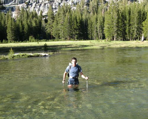
Update (May 18, 2023): Refer to this post for detouring around the damaged bridge over the South Fork of the San Joaquin. Update (May 22, 2023): More bridges are down. Plan accordingly. Every spring, creeks in the High Sierra rage with snowmelt. For one to two months, they are a grave danger, especially after snowy…
- « Previous
- 1
- 2