In March I was contacted by Sam and Steven Chaneles, a Miami-based father-son team who were planning to thru-hike the John Muir Trail in 2017. Due to permit availability and personal schedules, their dates were June 17 through July 9. They’d been watching the record-setting snowpack plots and were increasingly concerned about the feasibility of their plans given their thin backpacking resumes.
I was able to help them pare down their kits, talk through anxieties, and set their expectations — and then they did all the hard work (and had all the fun, and a heck of a father-son trip) in the High Sierra. After they returned, Sam wrote me and included a few photos and anecdotes. It sounded truly epic, and I thought their story was worth sharing — partly for the entertainment value, but also to help others better understand the challenges and hazards of early-season backpacking in the High Sierra, especially after an exceptionally wet winter. Sam posted a more general trip report on his website, Engineered for Adventure.
In this four-part interview, Sam and I discuss:
- Snow coverage, navigation, traction & snowshoes
- Passes, axes, and crampons
- River fords
- Mosquitoes & final thoughts
Q | Describe your your prior backpacking experience — generally, in the High Sierra, and in early-season conditions.
A | Since I was young, family vacations have revolved around outdoor activities (hiking, skiing, fishing, etc.). My true “backpacking” experience began in the summer of 2016 when I went on an 11-day expedition to Alaska as an incoming freshman. The trip introduced me to Outdoor Recreation Georgia Tech (ORGT), one of the largest college outdoor recreation programs in the country.
From day one on campus I dove headfirst into every opportunity I could to get outside. I have since gained backpacking experience in the Southeast region (North Georgia, Tennessee, North Carolina) as a backpacking instructor with ORGT, leading overnight and multi-day trips, as well as receiving certification as a Wilderness First Responder. The experience and knowledge I gained over the past 12 months gave me the opportunity to return to Alaska this summer, this time as a co-leader of the 11-day expedition that started it all.
In terms of the High Sierra, before this trip I had NO experience. I had never been to the Sierra Nevada range, so humility and extensive pre-planning were critical. Additionally, I had extremely limited experience in the early season traveling on snowpack. It would be fair to say that this trip was a big leap forward, yet thankfully I was able to make the jump.
Q| What were your trip dates?
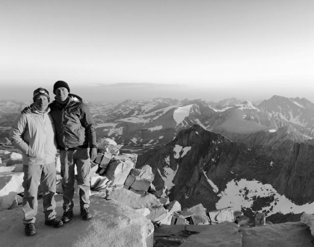
A | My father and I started out of Happy Isles on June 18 (coincidentally, Fathers’ Day), reaching the 14,508’ summit of Mt. Whitney on the night of July 6 (19 trail days). We passed the following landmarks on the following dates (to give a time frame reference for trail conditions):
- Cathedral Pass – June 20
- Donohue Pass – June 21
- Island Pass – June 21
- Mammoth Pass – June 23
- Silver Pass – June 24/25
- Muir Pass – June 28
- Mather Pass – June 30
- Pinchot Pass – July 1
- Glen Pass – July 2
- Kearsarge Pass – July 2, 3
- Forester Pass – July 4
- Mt. Whitney – July 6, 7
Q | How much of the trail was covered by snow? How much of your time did you spend on snow? How often did you have to camp on snow?
For us, snow began around 8400’ just past Cloud’s Rest Junction (7.1 SoBo) on our climb out of Yosemite Valley towards Sunrise High Sierra Camp (10.0 SoBo). For this stretch snow lasted well into Tuolumne Meadows (22.3 SoBo), until around mile 26.0 SoBo (even in Tuolumne Meadows there were LARGE snow drifts lingering). Since no JMTers had come through this region yet, and PCT hikers were not coming down into Yosemite Valley, tracks were nonexistent during this stretch.
For the most part, Lyell Canyon was snow-free, with occasional snow drifts here and there. Snowpack resumed at the beginning of the ascent towards Donohue Pass (37.0 SoBo), right around mile 33 SoBo. From this point onward, snow lasted into Red’s Meadow (61.2 SoBo). The entire region between Donohue Pass and Red’s was COMPLETELY snow covered. Thousand Island Lake (43.6 SoBo), Ruby Lake (44.8 SoBo), Emerald Lake, Garnet Lake (46.2 SoBo), and Shadow Lake (49.9 SoBo) were ALL frozen-over. The ascent up to and down from Donohue Pass had been decently tracked by northbound PCT hikers, yet once past Thousand Island Lake (where the PCT diverges from the JMT) the tracks stopped, as few, if any, JMT hikers had been through the region at that point. Throughout the snow covered trail we encountered extensive suncups ranging from shallow to deep, which slowed our pace significantly.
At the time Red’s Meadow was closed to resupply, so we had to hike out to Mammoth Lakes. Mammoth Pass (64.2 SoBo) was almost completely snow-covered, yet since so many PCT hikers were coming in-and-out for resupply there were decent tracks to follow. Once down from Mammoth Pass snow was patchy, lingering on northward facing slopes (for us, uphills) and non-existent on southward facing slopes (for us, downhills). The climb up from Duck Pass Junction (72.5 SoBo) was a large snowfield, yet the descent down to Purple Lake (74.7 SoBo) was snow-free. The climb up from Purple Lake to Lake Virginia (76.7 SoBo) was almost completely snow-covered, as well as the traverse around Lake Virginia. The switchbacks down to Tully Hole (79 SoBo) were dry, yet snowpack resumed once we began climbing up towards Silver Pass.

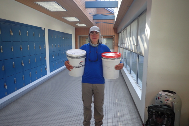
Christmas in June! I hold our resupply buckets in the Mammoth Lakes Post Office. At the time Red’s Meadow was closed for resupply.
The ascent towards Silver Pass (80 SoBo) was completely snow-covered, with good tracks from PCT hikers remaining. At the time many PCT hikers had been coming up through Goodale Pass instead of Silver Pass because of a difficult crossing of the North Fork of the Mono River. Because of this, once past the Goodale Pass Junction (82.5 SoBo) on the way up to Silver Pass tracks stopped abruptly, as few PCT hikers had been tracking up through Silver Pass. Dry trail began again once past the crossing of the North Fork of the Mono River (87 SoBo) and continued down to Lake Edison.
We bypassed the Bear Creek section of the trail because at the time the crossing was considered impassable at the normal crossing, requiring alternative crossing several miles upstream, which turned one crossing into several, difficult crossings. At the time what seemed like the overwhelming majority of northbound PCT hikers opted to bypass the Bear Creek section (from Muir Trail Ranch junction to Lake Edison junction), choosing to hike out to Florence Lake via the Florence Lake Trail and then hike up to Vermillion Valley Resort. Frankly, the Florence Lake Trail was scenic and enjoyable, and for us, a safer option than attempting Bear Creek.
Once back on the trail, snowpack began again at the outlet of Evolution Lake (124.2 SoBo), continuing for the entire ascent up to Muir Pass (130 SoBo) and lingering for nearly 4-5 miles after Muir Pass (dry trail began again around 135 SoBo).
The Golden Staircase was snow-free, yet beginning at the outlet of Lower Palisade Lake (147.6 SoBo) snowpack began again, continuing the entire way up to Mather Pass (151.5 SoBo) and lasting until Sawmill Pass Junction (165 SoBo). Between Mather Pass and Pinchot Pass (161.3 SoBo) large snowfields with decent tracks were present. Both the ascent and descent of Mather Pass were very well tracked from northbound PCT hikers. Once down from Mather Pass, however, tracks stopped, as hikers were taking many different routes to avoid crossing the South Fork of the Kings River (157.1 SoBo). Decent tracks began back up again once past Taboose Pass Junction (158.3 SoBo), and continued all the way up to Pinchot Pass. Coming down from Pinchot Pass was well tracked from PCT hikers, yet tracks ended once the treeline began again, around mile 163 SoBo.
Snowpack resumed once past the Baxter Creek crossing (171.4 SoBo), continuing until 1-2 miles after Glen Pass (177.4 SoBo). The JMT crossing of the Arrowhead Lake Outlet was at the time too deep to ford (a ranger estimated the water to be over 8 feet deep), so we chose to cross at the inlet of Arrowhead Lake, which turned out to be thigh deep at most. The trail around the Rae Lakes was still snow covered at the time, yet melting fast. The ford between the Rae Lakes (175.6 SoBo) was nearly chest high when we crossed at around 7 in the evening (and very cold!).
The climb up to and descent down from Glen Pass was completely snow-covered, yet very well tracked (the snowline stopped around 1-2 miles past Glen Pass). The hike out Kearsarge Pass (179.5 SoBo) was mostly snow-free, with occasional patches of snow here and there.
Snow began again around mile 187 SoBo on the ascent up to Forester Pass. For the first mile or so through the snow, tracks were non-existent, yet good tracks were present on the final ascent towards the pass. The top of Forester Pass (189.5 SoBo) was actually snow-free, as were the switchbacks on the descent down from the pass. The infamous “ice chute” had nearly melted out at that point; instead of having to traverse across snow there were steps on scree rock.
Large patches of snow were present on the plateau after Forester Pass, continuing until around 1 mile before the trail crossing of Tyndall Creek (190.4 SoBo). From this point onward the trail was mostly snow-free, with occasional patches of snow around Guitar Lake (205.6 SoBo). The switchbacks up to Whitney were completely dry, as was the final ascent up to the summit. The final 500 vertical feet up to Whitney summit were snow-covered, yet alternate routes through dry rock scramble were marked by cairns.
The descent from the Whitney Trail Crest was completely snow-covered, yet very good glissade marks were present (it almost looked like a bobsled track). Snow continued for around 2-3 miles of the descent down from Whitney summit towards Whitney Portal.
When traveling through snow-covered regions we usually were able to find a level rock on which to make camp. Only once did we have to camp on snow, right before Silver Pass above Chief Lake.
Q | How did you navigate when the trail was snow-covered?
When the trail is completely snow-covered it is CRITICAL to utilize off-trail navigation techniques. We utilized tracks from PCT hikers when they were present, saving us the energy of slogging through miles of suncups, periodically confirming our direction with our GPS device to avoid blindly following the tracks of others. Yet when tracks were not present we utilized off-trail techniques, using line of sight navigation, taking bearings when necessary, and picking a “line of travel” and sticking to it.
When the trail is under snow there is NO need to follow it exactly. Stopping and looking at your GPS every five feet or so to make sure that you are on top of the trail is useless. Instead, utilize the snow to your advantage when there are no tracks and forge your own path. Understand where you are trying to end up, analyze the obstacles in between you and your target, and pick a “line of travel.” Snow allows you to travel in straight lines, which can be much more efficient than trying to zig-zag with the trail when it is 5 feet beneath your feet.
Q | How did you mitigate the reflectivity of the surface and the extreme radiation?
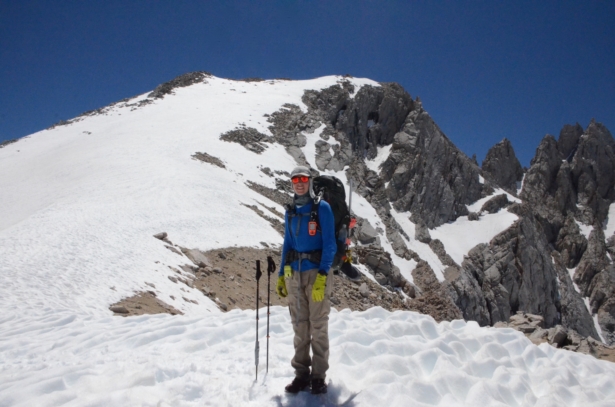
When traveling on snow the sun will bake you alive if you are not careful. When traveling on snow I was covered nearly head-to-toe with SPF clothing. My protection was as follows:
- Arc’teryx Cormac long-sleeve shirt with SPF 50 protection
- Prana Zion Convertible Pants for my legs
- UV Protection Buff for my neck and lower faceOutdoor Research Active Ice Cap for my neck and face
- Dragon Alliance MountaineerX polarized sunglasses with “glacier” glass attachments to protect peripheral vision
- Outdoor Research Active Ice Sun Gloves*
- Dermatone SPF 23 for my lips and face to prevent chapping*

My outfit for snow travel. I did my best to cover myself from head-to-toe. Normally by Buff would be covering my face as well.
*At the beginning of the trips I did not have these items. Before my dad recommended we purchase sun gloves in Mammoth Lakes my hands were literally cooked from travel on the snow, to the point that they were bleeding in places. My lips too fell victim to the vicious glare from the snow, blackening in places due to sunburn. I had thought that simply applying sunscreen to my hands would protect them from the sun. Unless you reapply sunscreen every 30 minutes or so the sun will bake your hands alive. I can honestly say that the purchase of sun/glacier gloves was the BEST purchase I made on trail, as the condition of my hands significantly improved from that point onward. I would INSIST that early season hikers consider them an essential part of their clothing system.
We did encounter quite a few PCT hikers who did not have the same mindset about sun protection as we did. They looked as if they had been sitting on the beach for a week without sunscreen, as their legs and arms looked more like a rotisserie chicken than human skin.
Q | Did you carry snowshoes or skis? If so, how often did you wear them? If not, how much postholing did you do? What was the relationship between postholing and time of day, elevation, slope aspect, and snow depth?
We did not carry snowshoes or skis, as the snow was compacted to the point that these items would be of little benefit. Once the soft, powdery spring snow undergoes a cycle of thawing and refreezing (this usually occurs in mid-to-late May) the benefits of snowshoes or skis diminish significantly.
Throughout our entire trip I believe I only postholed (meaning fell-through the snowpack) 3 times, and my dad 3 as well. In the morning the snow is a crusty, concrete-like surface after having re-frozen overnight. Once the sun begins to bake it again, by early afternoon the snow has become a slushy mess, in which traction devices (such as crampons) are useless.
Postholing was more of a concern in the afternoon. By avoiding traveling near rocks (to avoid “elephant traps”) and other buried debris, you can avoid postholing nearly altogether.
The more challenging snow conditions were the suncups on which it is easy to turn an ankle or torque a knee if not careful. The art of gliding across suncups is one that many attempt and few master. As a skier, I can say that moving across suncups can be a bit like skiing a mogul field. One can look ahead and pick a line across perhaps a shallower area or natural tracks created from runoff from melting snow.


